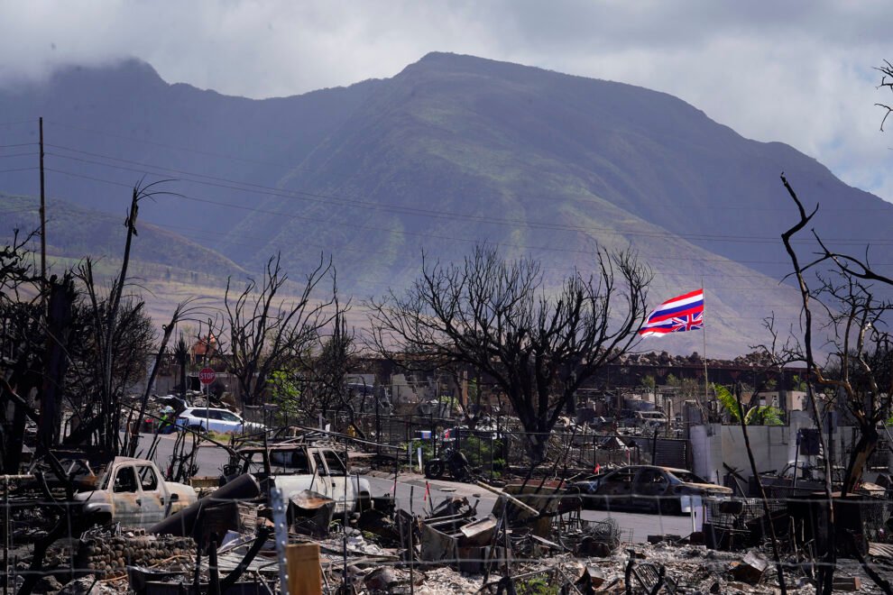
University of Hawaii researchers are pushing to kickstart the second phase of a yearslong project to help the state better forecast wildfires by using artificial intelligence.
Researchers say they have developed the technology needed to boost risk assessments at a hyper-local level on a daily basis after collecting historical wildfire and weather data over the past few years.
Lawmakers will likely take up measures related to the use of AI in disaster mitigation during the 2024 legislative session, which begins in January. The technology is part of a suite of potential actions the state can take to boost its defenses against wildfires that interim House working groups are considering.
Forecasting should be high on the list, according to lead researcher and UH engineering professor Sayed Bateni, who has led the AI-based system’s development.
Bateni’s work has so far been funded by FEMA and the Hawaii Emergency Management Agency but the technology and its potential is now being shopped around the Legislature, which is being asked to pony up funds to bolster its abilities.
The goal is to enable Hawaii to understand fire risk by drawing upon historical and real-time data that accounts for Hawaii’s diverse climate and topography, considering 13 separate variables through machine learning.
Currently, Hawaii’s only fire-risk forecast comes from the National Weather Service, whose red flag warnings are made from a single weather station at Daniel K. Inouye International Airport.
That is “lousy” for an archipelago with among the most diverse sets of climates in the world, according to Bateni.
“This is one of the main things we should be doing in response: Making sure we have better monitoring.”Thomas Giambelluca, director of the University of Hawaii Water Resources Research Center
“What’s happening in Honolulu airport has nothing to do with what’s happening on the other side of the island or what’s happening on Maui or Big Island,” Bateni said.
His work has collated location-specific data for the entire state, broken down into 250-square-meter chunks.
“You kind of need that in Hawaii, where the climate gradient is so steep,” said climate scientist Ryan Longman, an Oceania research fellow at the East-West Center in Honolulu.
The first phase of developing the machine-learning technology has enabled AI to create daily fire-risk assessments, though those are only completed late at night, once the day has already passed.
The second phase would overcome that shortcoming by forecasting fire risk for two days in the future, Bateni said.
Completing the second phase would cost approximately $1.5 million and take about three years to roll out, Bateni said. The final two phases will include consultation with key agencies, such as the Hawaii Emergency Management Agency, and outreach with the public.
Bolstering Hawaii’s Weather Service
Meteorologists have identified gaps in the state’s climate monitoring network for years.
Thomas Giambelluca, director of the Water Resources Research Center at UH, has long sought to address Hawaii’s dated and fragmented meteorological infrastructure. He’s the driving force behind the creation of Hawaii Mesonet, a network of 100 weather stations that feed information into a centralized location.
The Aug. 8 fires underscored the weather-monitoring gaps, particularly in West Maui, which until October did not have a weather station, relying instead on data from Kahului Airport.
“This is one of the main things we should be doing in response: Making sure we have better monitoring, including fire weather,” said Giambelluca, who’s also a UH environment and geography professor.

The new stations are scanned every four seconds, averages are calculated every five minutes, and data is transmitted every 15 minutes from across the state.
That data is then being fed into the Hawaii Climate Data Portal, among other destinations, where it can be used by researchers and the public.
Longman says the data that has been gathered into the portal, and is being fed through the Mesonet, is marking a shift in the quality of data and forecasting that Hawaii can do.
In the past, he said, gathering data for research was “a real fragmented process.”
“Bringing the data together, getting it all into one place, was just such a huge undertaking,” Longman said. “We’re in a really interesting time now, where everything is now kind of centralized. And we are developing products.”
Bateni’s fire-risk assessment is just one of several other products that will benefit from the improved data. Others look at flood, drought and even assessing the risk of avian malaria.
So far 36 stations have been installed across the island chain, including one last month in Lahaina.
Some of the sites identified for weather stations are being reassessed with wildfire in mind, considering the events of Aug. 8, but Giambelluca aims to have them all installed by the end of 2024.
The 100 stations have been funded by the National Science Foundation and the data will be sold to the National Weather Service, which will cover about 50% of the roughly $500,000 annual operational and maintenance costs.
The remaining funds would have to come somewhere else, and Giambelluca said he was “still very optimistic” the Legislature would help.
Rep. Linda Ichiyama, who co-chairs the House Wildfire Prevention Working Group, said the Hawaii Mesonet is an “incredible resource” and that she would “definitely put it up for discussion” next session.
Source : CivilBeat


